“How shallow is it out there?” is the first question anyone asks about the Florida Keys flats, and the honest answer is: it depends which side of the bridge you are on, and which part of the chain. We put three of our live depth maps side by side, Marathon in the Middle Keys, Big Pine and Bahia Honda in the Lower Keys, and Islamorada in the Upper Keys, to show what the water actually looks like from above.
All depths here are at low tide (the same level US charts use), so on most days you will have a little more water than the map shows. Each map has a typical error of about 3 to 5 ft, printed on the map itself, which is plenty to see where the flats and channels are but not enough to promise you an exact inch over a bank.
Marathon: two very different shores
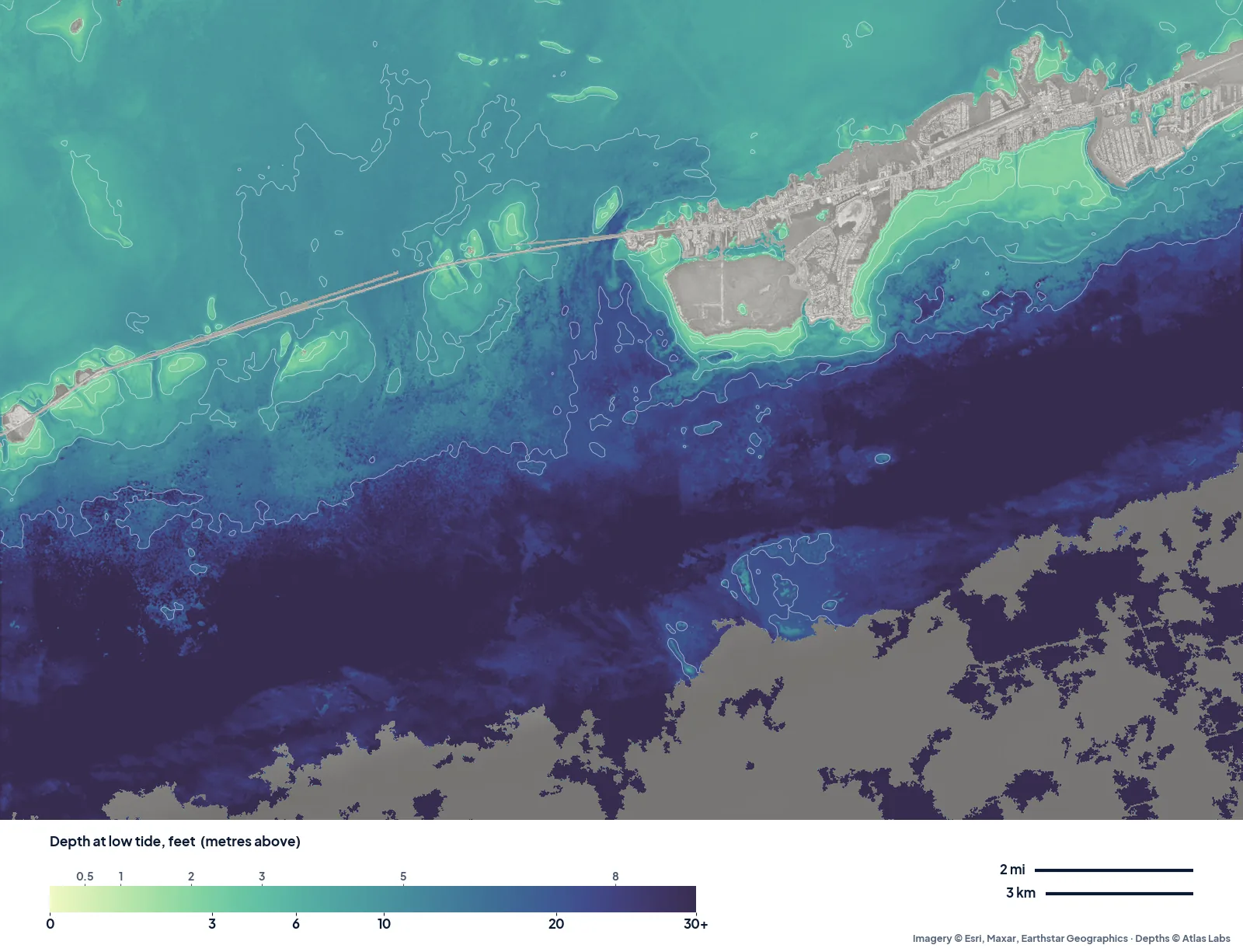
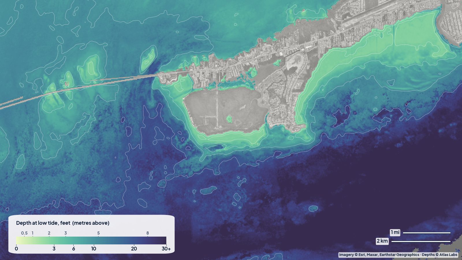
Marathon at low tide. Pale green hugs both shores and Boot Key; the blues to the south step down to Hawk Channel and the reef.
On the map, the water just off Marathon’s shores reads mostly 5 to 8 ft, both on the bayside to the north and off Sombrero Beach on the ocean side. Hawk Channel, a mile or two offshore, reads close to 30 ft, and the reef line beyond rises again. The flats either side of the Seven Mile Bridge read around 10 ft on the map in the open stretches, with the shallowest pale-green patches strung along the bridge and around the small keys.
What that means in practice: Marathon’s bayside is friendlier to a bay boat than it looks from the shore, and Sombrero Beach is an easy kayak launch onto 5 to 8 ft of water that deepens gradually. The full Marathon guide is here: Marathon and the Seven Mile Bridge flats.
Big Pine and Bahia Honda: the channel country
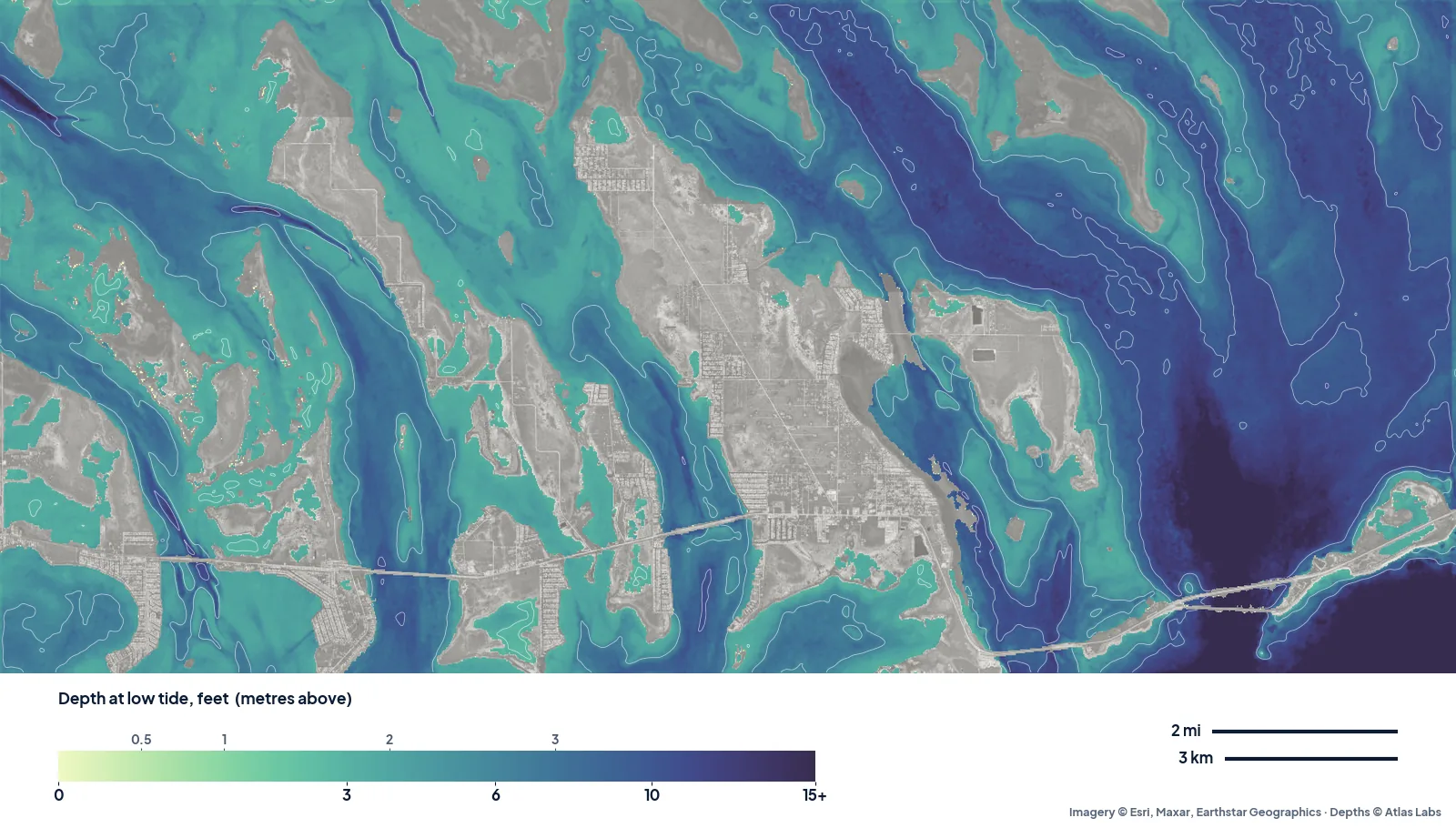
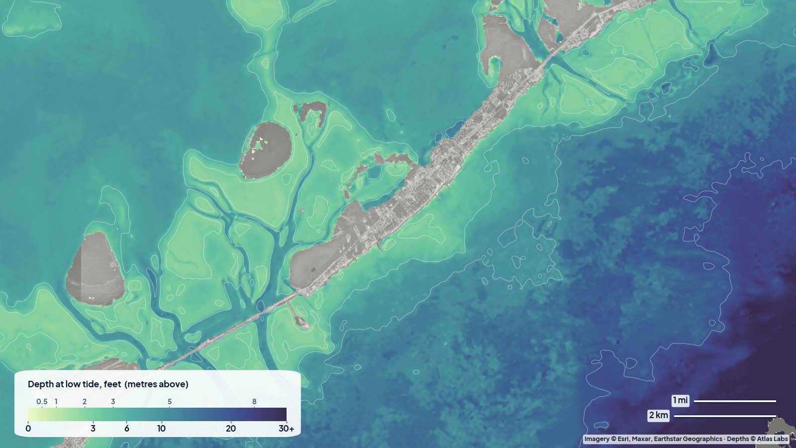
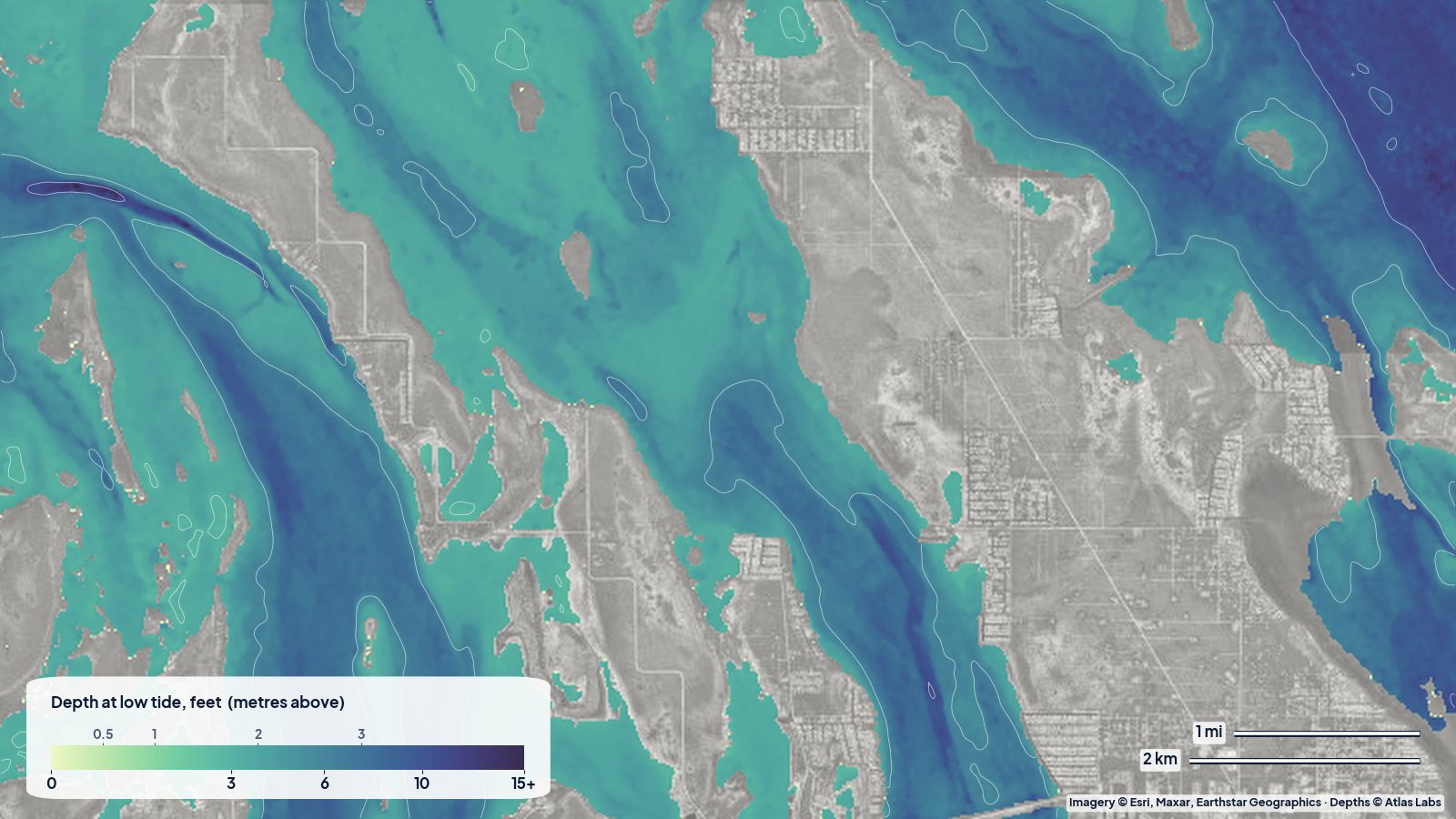
Big Pine Key to Bahia Honda at low tide. Long blue fingers are the natural channels; pale green between them is flat.
This is the most striking of the three maps. The Lower Keys around Big Pine are cut by long, straight, north–south channels with banks between them, and the map shows it clearly. Taken as a whole, about a third of the mapped water here reads 2 to 5 ft and another four in ten reads 5 to 10 ft; in the middle of the Big Pine backcountry, half the water reads under about 5 ft.
That is skiff and kayak country. The rule is simple: run the blue, pole or paddle the green. If you are in a boat that draws more than a foot, the channels are your roads and the banks are the fields beside them. The full guide: Bahia Honda depth map for kayaks and snorkelers.
Islamorada: wide banks, narrow cuts
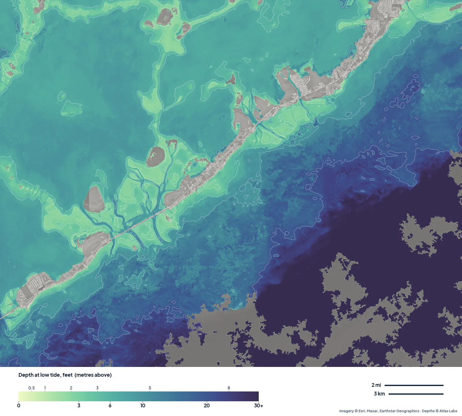
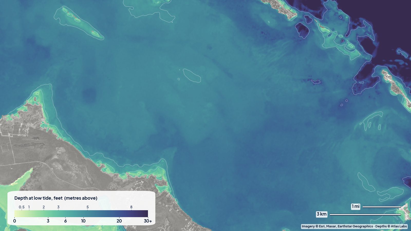
Islamorada at low tide. Broad backcountry banks cut by narrow channels on the bayside; the ocean side drops toward the reef.
In the Islamorada backcountry the map shows wide, even banks that mostly read 7 to 9 ft, with the shallowest quarter of the water under about 7 ft and the pale strips along the islands much shallower. The channels that cut through the banks are narrow and easy to miss from the water, but stand out on the map. On the ocean side, the shelf runs out to the reef before dropping away.
The full guide: Upper Keys backcountry: Key Largo and Islamorada.
So how shallow are the Keys flats?
- Lower Keys (Big Pine): the shallowest of the three. A lot of water under 5 ft, organised in long banks and channels. Best for kayaks, paddleboards and poling skiffs.
- Middle Keys (Marathon): mostly 5 to 10 ft close in, with the shallowest water hugging the shorelines and the bridge.
- Upper Keys (Islamorada): broad banks that read in the high single digits, with narrow cuts. Easier for bigger boats in the open, trickier near the islands.
On a spring low after a north wind, take a couple of feet off all of these. On a high tide with a south-east breeze, add one.
Reading the map for your draft
- Kayak or paddleboard (4 to 6 in): you can float almost anywhere on these maps; use the channels to avoid dragging over grass at low water.
- Poling skiff (8 to 12 in): the pale-green areas are your hunting ground, but plan your way out through the blue before the tide drops.
- Bay boat (15 to 20 in): stay in water the map shows as 4 ft or deeper and add a margin for the typical error.
Seagrass scars take years to heal and can bring a fine in the Keys, so if you touch bottom, stop, tilt up and pole off.
Open the live maps
Tap any spot for the depth in feet: Marathon, Big Pine and Bahia Honda, Islamorada. For the rest of the chain see the Florida Keys spot hub.
Frequently asked questions
Are the Florida Keys flats really only a foot deep?
Some banks are, especially at low tide and along the islands, but large parts of the backcountry read 5 to 10 ft on our maps. The very shallow water sits in strips and patches, not everywhere.
Which part of the Keys is best for kayak fishing?
The Lower Keys around Big Pine, where the map shows long banks under 5 ft with channels between them, and the bayside of Marathon for easier, slightly deeper water.
How accurate are these maps?
Each map shows its typical error, between about 3 and 5 ft for these three. See how accurate satellite depth maps are for how we check them.
Related reading
- Florida Bay for skiffs: the channels off Flamingo
- Biscayne Bay shoals: the Safety Valve and Stiltsville
- Marathon and the Seven Mile Bridge flats
Safety note: ShoalScope depth maps are satellite estimates for planning, not for navigation. Use official charts and your own eyes on the water, and always wear a life jacket.