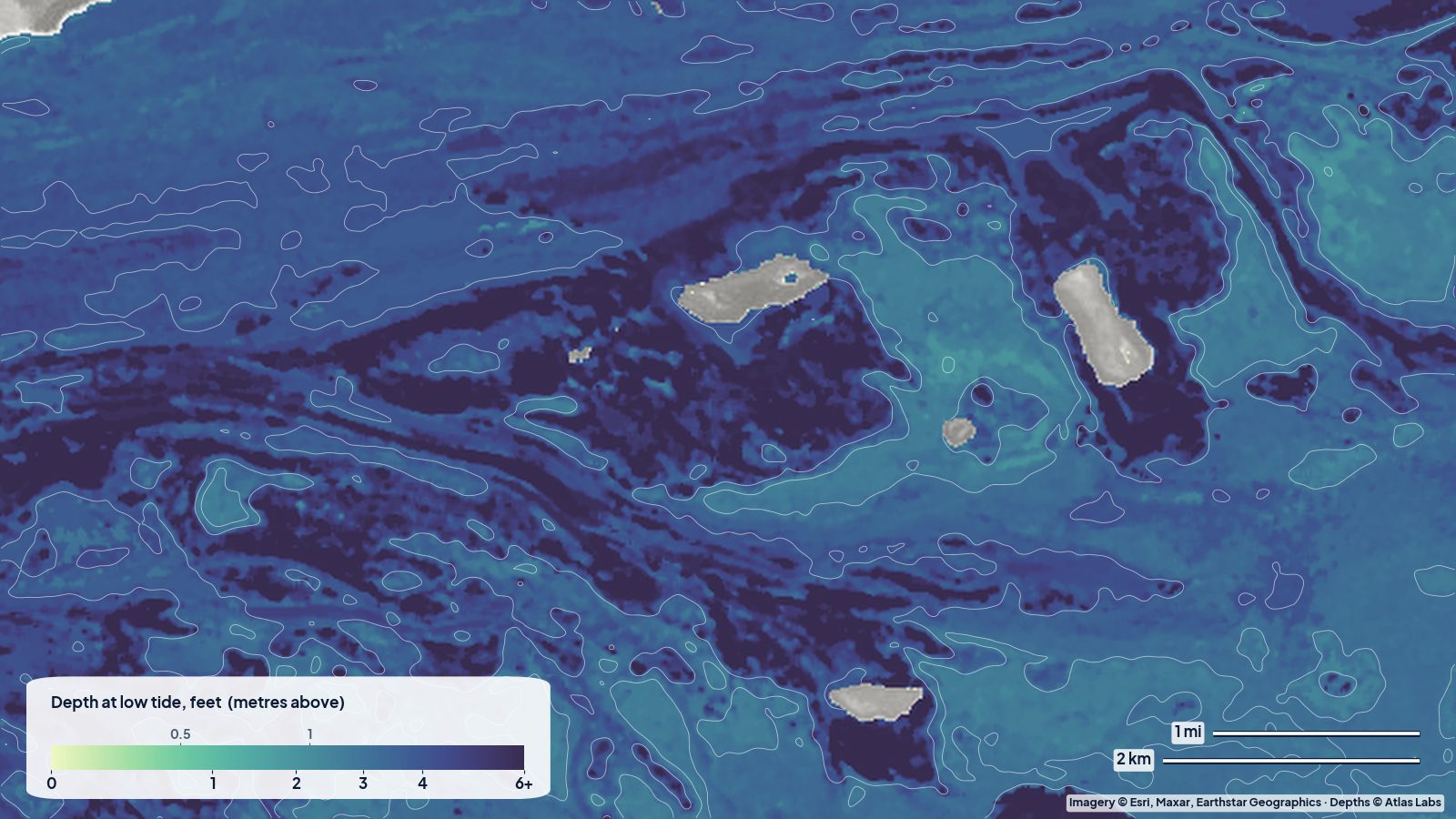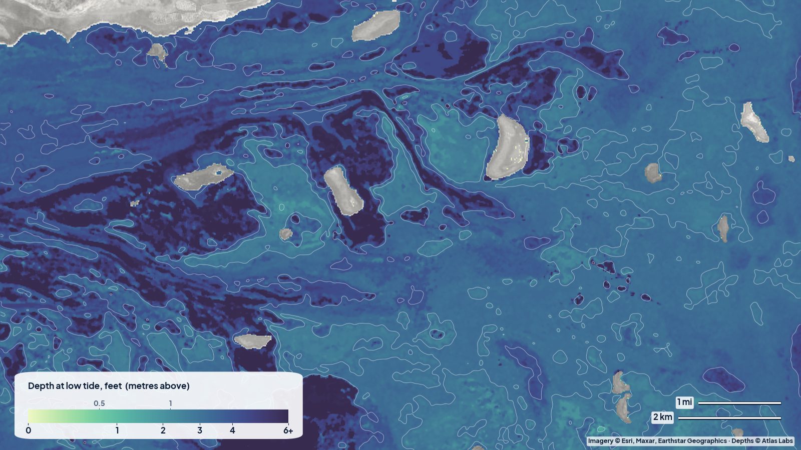
Florida Bay is the huge triangle of water between the southern tip of the Everglades and the Florida Keys. Almost all of it sits inside Everglades National Park, and almost all of it is shallow. The park’s own boating guide describes the bay as a few dozen basins, most less than 5 ft (1.5 m) deep, separated by banks where the water is only inches deep. Some of the passes through those banks hold less than 16 in (40 cm) in winter. If you fish, paddle or run a skiff out of Flamingo, understanding that pattern is the whole game. This guide lays it out in plain language. The satellite depth map for the Flamingo cell is updated regularly and shows the banks and basins in colour.
What the bottom looks like
- Basins: broad, flat-floored bowls of turtle grass over soft mud or marl. Water is often tea-coloured near the mainland and clearer toward the Keys.
- Banks: shallow ridges of sand, mud and grass that separate the basins. Many are exposed or awash at low water, with mangrove islands growing on the higher parts.
- Passes and channels: narrow gaps through the banks, some natural, a few marked. They are the only way to move a boat from one basin to the next.
- The Flamingo shoreline: a mangrove coast with mud flats, Snake Bight to the east and the mouths of creeks that drain the Everglades. The “front” of Flamingo is the classic flats-fishing water for redfish and snook.
- Whitewater Bay and the backcountry (north of Flamingo via Buttonwood Canal): a separate world of brackish bays, creeks and mangrove rivers.
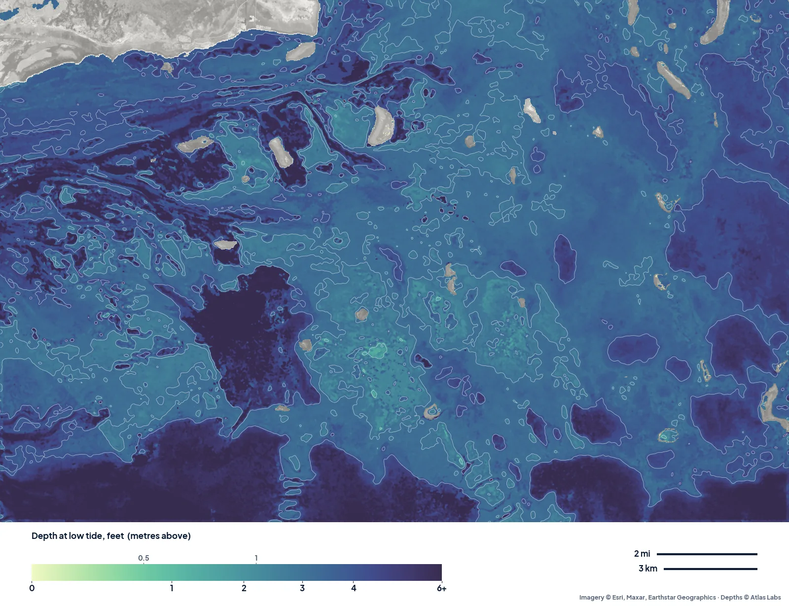
The real depth map of Florida Bay off Flamingo. Almost all of it reads 2 to 5 ft at low tide; the darker winding lines are the natural channels and lakes between the mud banks, which is where a skiff wants to be. Note the colour scale here only runs to 6 ft.
Approximate depth by zone
Typical ranges only. Water level in Florida Bay is driven as much by wind as by tide, so always check the live map and the forecast.
- Banks: 0 to 1 ft (0 to 0.3 m) at low water; many dry out completely. Passes across the banks: roughly 1 to 3 ft (0.3 to 0.9 m).
- Basins: roughly 2 to 5 ft (0.6 to 1.5 m). The deepest natural water in the bay is reported at about 9 ft (2.7 m) and is rare.
- Snake Bight and the Flamingo “front”: mud flats of roughly 6 in to 2 ft (15 to 60 cm), the sight-fishing zone, dropping to 3 to 5 ft (0.9 to 1.5 m) at the outer edge.
- Flamingo marina channel and Buttonwood Canal: dredged, roughly 4 to 7 ft (1.2 to 2.1 m) but shallow at the marina entrance on a low tide.
- Whitewater Bay: roughly 3 to 6 ft (0.9 to 1.8 m) over most of its area, with deeper creeks.
Launch points and boat ramps
- Flamingo Marina (Everglades National Park): two ramps, one into Florida Bay and one into Buttonwood Canal and the backcountry; fuel, a small store and kayak and canoe rentals. Park entrance fee applies.
- Flamingo campground and visitor area: carry-in launch for kayaks and paddleboards straight into the bay.
- Keys bayside ramps (Islamorada, Key Largo): the other way in. Most guides working the central and eastern bay launch from the Keys. See the Upper Keys backcountry guide.
- Chokoloskee and Everglades City: access to the far western Everglades, covered in the Ten Thousand Islands guide.
Best tide, wind and season
- Tide and wind: The tide range at Flamingo is small, around 1 to 2 ft (0.3 to 0.6 m), and a steady north or east wind can push more water out of the bay than the tide puts in. A rising tide with a light southerly fills the flats; a hard norther after a cold front leaves them dry for days.
- Season: The dry season, November to April, has the best weather, the lowest water and the fewest mosquitoes. Spring brings tarpon to the channels and basins. Summer is hot, wet and buggy, but the backcountry fishes well early and the water is at its highest.
Hazards
- Grounding: This is the main hazard in Florida Bay. Hundreds of boats a year get stuck on banks, often for a full tide. The park’s pole-and-troll zones and no-motor zones exist to protect seagrass; know where they are.
- Remoteness: Cell coverage is patchy. Carry a VHF radio, water and a push pole.
- Crocodiles and alligators: Common around Flamingo; give them space and keep dogs out of the water.
- Mosquitoes and no-see-ums: Brutal in summer and at dusk year round.
- Weather: Fronts in winter and thunderstorms in summer arrive fast across open, shallow water that gets choppy and muddy.
Kayak and skiff draft guidance
Kayaks and canoes (4 to 6 in, 10 to 15 cm of draft) are the ideal Florida Bay craft. You can cross most banks at mid to high water and portage or wade the rest. The Flamingo-area paddling trails and the Wilderness Waterway start here.
Technical poling skiffs drawing 6 to 10 in (15 to 25 cm) are what the guides use, running the channels and poling the basin edges. Even they get stuck. Bay boats drawing 12 in (30 cm) or more should stick to marked routes between Flamingo and the Keys and stay in basins the map shows at 3 ft (0.9 m) or more. Never run a bank you have not seen on the map and on the water. Allow at least 1 ft (0.3 m) of margin above your draft, more when the wind is north or east.
Frequently asked questions
How deep is Florida Bay?
Mostly under 5 ft (1.5 m). The bay is a set of shallow basins separated by banks that are only inches deep or dry at low water. The deepest natural spots are reported at about 9 ft (2.7 m).
Can I take a bay boat out of Flamingo?
Yes, in the marked channels and deeper basins, with care on a low tide. The banks and Snake Bight are skiff and kayak water only.
Is there a boat ramp at Flamingo?
Yes, Flamingo Marina has ramps into Florida Bay and into Buttonwood Canal for the backcountry, with rentals and fuel.
What draft do I need to fish the Flamingo flats?
A poling skiff drawing 6 to 10 in (15 to 25 cm), or a kayak. The best sight-fishing water is 6 to 18 in (15 to 45 cm) deep.
When is the water highest in Florida Bay?
Late summer and early fall, and on days with a southerly wind. Winter northers push water out and leave the banks exposed.
Related reading
- Upper Keys backcountry depth map
- Ten Thousand Islands depth map
- Marathon and Seven Mile Bridge flats
Safety note: ShoalScope depth maps are satellite estimates for planning only and are not for navigation. Follow Everglades National Park boating rules and zones, carry a VHF radio, and wear a life jacket.