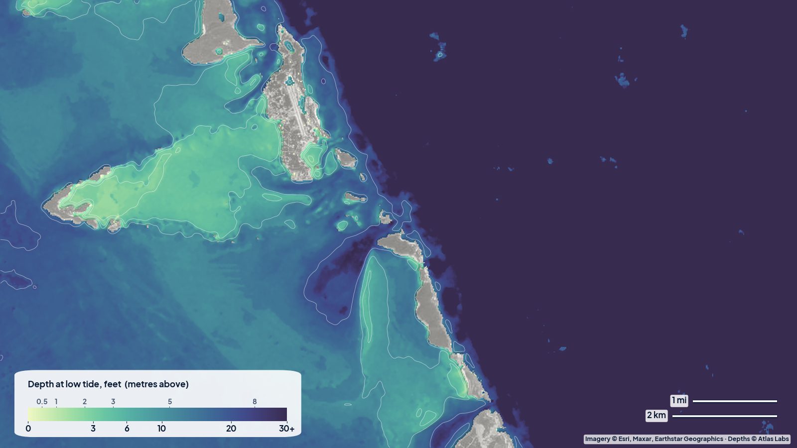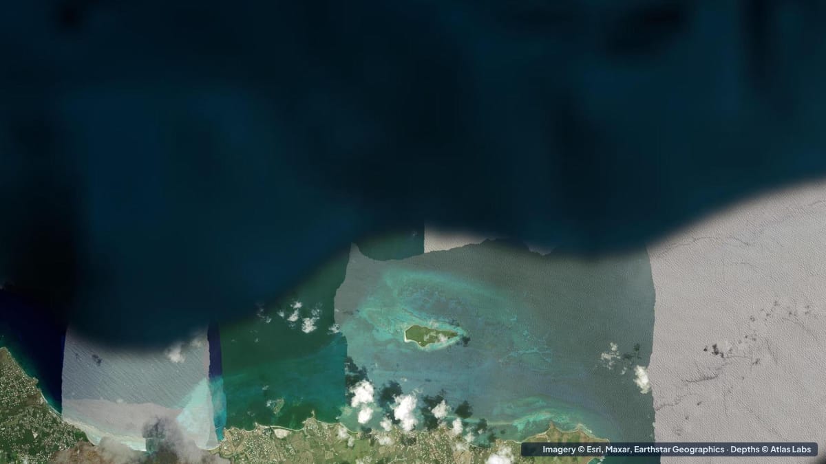
Buck Island sits about 1.5 miles (2.4 km) off the north-east coast of St Croix and has been a national monument since 1961, one of the first fully protected marine areas in the United States. Two thirds of the island is wrapped in an elkhorn coral barrier reef that encloses a shallow, calm lagoon, and inside it the National Park Service maintains an underwater snorkel trail with signs on the bottom. Turtle Beach, on the island’s west end, is routinely listed among the most beautiful beaches in the world. This guide explains what is where, typical depths, how to get there, when to go and what to avoid. The satellite depth map for this cell is updated regularly.
What the bottom looks like
- The lagoon (north and east sides): a shallow, sand-floored basin between the island and the barrier reef, with seagrass patches, coral heads and the famous grottoes and canyons of the underwater trail at the eastern end.
- The barrier reef: a wall of elkhorn and other hard corals that reaches the surface in places and takes the full force of the trade-wind swell on its outside.
- Turtle Beach and the west end: a long sweep of white sand with a gentle sandy slope and seagrass offshore, sheltered from the trade wind, where the boats anchor and the picnic area sits.
- South shore: rocky, with a fringing reef and the Buck Island channel between the island and St Croix.
- Outer shelf and the drop-off: beyond the reef the shelf runs out and falls away; dive boats use sites on the island’s deeper northern slope.
Approximate depth by zone
Typical ranges only. The tide range is small, around 1 ft (0.3 m); swell is what changes conditions. Check the live map.
- Lagoon inside the barrier reef: the park describes wide, shallow lagoon waters that seldom exceed 12 ft (3.7 m).
- Underwater trail and grottoes: roughly 6 to 12 ft (1.8 to 3.7 m), with the maximum in the grottoes about 12 ft (3.7 m).
- Barrier reef crest: awash to 3 ft (0 to 0.9 m), with breaking swell on the outside.
- Turtle Beach swimming area: roughly 1 to 8 ft (0.3 to 2.4 m) within the first 50 yards, sand bottom.
- Anchorage off Turtle Beach: roughly 8 to 20 ft (2.4 to 6 m) over sand.
- Dive sites on the outer slope: roughly 16 to 46 ft (5 to 14 m) on the shallow sites, deeper beyond.
- Buck Island channel toward St Croix: roughly 20 to 60 ft (6 to 18 m).
Getting there, launches and moorings
- Concession boats from Christiansted and Green Cay Marina: half-day and full-day sail and power trips are how almost everyone visits; they include snorkel gear and the trail.
- Private boats: permitted with a free park permit; the lagoon has marked mooring buoys for the snorkel trail and an anchorage in sand off Turtle Beach. Anchoring on coral or seagrass is prohibited.
- Kayaks and paddleboards from St Croix: the crossing from the north-east shore (Green Cay or the Tamarind Reef area) is about 1.5 to 2 miles (2.4 to 3.2 km) of open water with current and trade-wind chop; only for experienced paddlers in calm conditions, and only with a permit.
- St Croix ramps: public ramps at Christiansted, Gallows Bay and the north-shore marinas for small boats.
Best tide, wind and season
- Tide: Minor. Snorkel the trail in the late morning for the best light.
- Wind: The trade wind from the east keeps the lagoon’s eastern end choppy on windy days and leaves Turtle Beach calm. Concession boats cancel the trail in strong easterlies or north swells.
- Season: December to April is dry and busy, with occasional north swells that stir up the lagoon. Summer is calmer, hotter and quieter, with the clearest water. Hurricane season peaks August to October.
Hazards
- Current in the lagoon’s eastern end and the channel: Water pushed over the reef by swell drains out through gaps, creating current that can carry snorkelers toward the reef or the open sea.
- Elkhorn coral: Sharp and fragile, often within inches of the surface. Never stand on or touch it.
- Boat traffic: Concession boats arrive and leave at set times; stay inside marked areas.
- Sun and heat: The island has little shade and no fresh water.
- Protected area rules: No fishing, no collecting, no anchoring on reef or seagrass; permits required for private boats.
Kayak and small-boat guidance
Kayaks and paddleboards (4 to 6 in, 10 to 15 cm of draft) can explore the whole lagoon and Turtle Beach once there; getting there is the challenge. Most paddlers bring boards on a charter or private boat rather than crossing.
Private boats drawing 2 to 6 ft (0.6 to 1.8 m) must use the marked channel into the lagoon, the trail moorings and the sand anchorage off Turtle Beach. Inside the lagoon, expect coral heads to rise to within a few feet of the surface; motor slowly and watch the map.
Frequently asked questions
How deep is the water at Buck Island?
The lagoon inside the barrier reef seldom exceeds 12 ft (3.7 m). The underwater trail is in roughly 6 to 12 ft (1.8 to 3.7 m), and Turtle Beach shelves gently from the sand.
Can beginners snorkel the Buck Island underwater trail?
Yes, in calm conditions. The trail is shallow and marked, but current can run in the lagoon’s eastern end, so stay with your group and follow the guide’s briefing.
Can I take my own boat to Buck Island?
Yes, with a free park permit. Use the marked channel, the trail moorings and the sand anchorage off Turtle Beach, and never anchor on coral or seagrass.
Can I kayak to Buck Island?
Experienced paddlers can cross from St Croix’s north-east shore on calm days with a permit, but most visitors bring boards on a boat.
What is the best time of day to visit Buck Island?
Late morning for the snorkel trail, when the sun is high and the light on the coral is best.
Related reading
Safety note: ShoalScope depth maps are satellite estimates for planning only and are not for navigation. Coral heads rise suddenly inside the lagoon. Follow National Park Service rules and the briefing from your captain, and never snorkel alone.